If summer swimming sounds like a blast, just make sure you know what you’re diving into.
A cyanobacterial harmful algal bloom (cyanoHAB) is an environmental event that occurs when cyanobacterial algal populations become incredibly dense and threaten human and ecosystem health. CyanoHABs have become more common in recent years due to increasing temperatures, which create hospitable waters for algal blooms; New York State reported more than 1,000 toxic blooms in 2019 alone. CyanoHABs can pose human health risks when lake goers in affected water are exposed to cyanobacterial toxins through accidental ingestion of cyanoHAB-affected water while swimming, inhalation of water vapor while boating or water skiing, and direct skin contact while swimming or wading.
Environmental managers have a big stake in preventing these risks. The most common method of monitoring toxic blooms on site is water sampling, which can be intermittent and costly. But our article recently published in GeoHealth shows that satellite data can serve as a valuable complement to on-site testing for detecting cyanoHABs in recreational waters—a service worth hundreds of thousands of dollars in saved healthcare costs for a single cyanoHAB event.
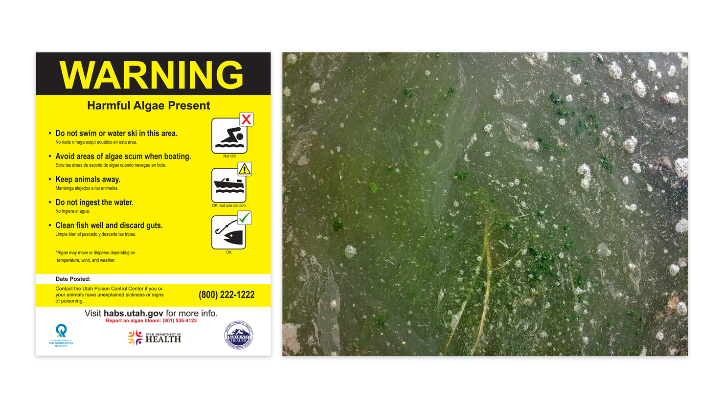
Local environmental and health agencies regulate recreational activities in water bodies to prevent cyanoHAB exposure whenever possible. Recreational area managers are charged with posting advisories or warnings when cyanoHABs are detected in a water body (Figure 1). Traditionally, decisions about issuing advisories and warnings are informed by regular on-site water quality testing that reveals whether algal blooms are present and if the blooms are producing harmful toxins.
Figure 1. Environmental managers close sites to visitors when harmful algal blooms—a toxic hazard to recreational swimmers, boaters, and water skiers—are detected in the area.

However, recent advances in satellite remote sensing offer new opportunities for environmental managers to monitor cyanoHABs. Specifically, satellite images can detect whether dense algae populations are present in a body of water on a daily basis, in contrast to the weekly or monthly frequency of typical on-site testing programs (though on-site testing is still needed to determine toxicity). These satellite images are now being used more frequently in water quality management, thanks to the availability of the CyAN tool developed by the US Environmental Protection Agency, NASA, the National Oceanic and Atmospheric Administration, and the US Geological Survey.
Satellite data can provide more frequent information about the presence of cyanoHABs, which can help inform when additional on-site testing is needed—and these benefits can be quantified. In our recent article in GeoHealth, we conduct an impact assessment in collaboration with Blake Schaeffer at the US Environmental Protection Agency, Signe Stroming from IDinsight, and Bethany Mabee from Resources for the Future (RFF) to evaluate the human health benefits of using these satellite data to respond to a 2017 cyanoHAB event in Utah Lake. This is one of several impact assessments produced by the VALUABLES Consortium, a cooperative agreement between RFF and NASA to quantify and communicate the socioeconomic benefits of Earth observations.
As with all of the VALUABLES Consortium’s impact assessments, our analysis follows a specific logic in which we consider what information is used to make decisions, how decisions are made, and how outcomes are affected by those decisions. Specifically, we compare health outcomes and associated healthcare costs in two worlds: one in which satellite data are available, and decisionmakers use those data to issue recreational advisories—which is what happened when a cyanoHAB developed in Utah Lake in 2017—and a counterfactual world, in which satellite data aren’t available (Figure 2).
Figure 2. Impact assessment framework that highlights benefits of using satellite data to detect cyanobacterial harmful algal blooms in Utah Lake.

Using information gathered from experts familiar with the HAB testing process used by the Utah Department of Environmental Quality (DEQ), along with agency documents detailing the decisionmaking process for posting recreational advisories, we estimate that the satellite-based CyAN tool allowed decisionmakers to issue an advisory seven days earlier than the counterfactual world, in which the data were not available. We combine this finding with information collected from Utah Lake State Park visitation records and Google reviews of Utah Lake access points to estimate that 8,000 people would have visited the lake in the absence of advisory postings. We then leverage public health research and data from the Utah Poison Control Center and estimate that 400 Utah Lake visitors would have gotten sick without the early advisories.
As a final step, we reference the health economics literature to estimate the cost of those illnesses. For the Utah Lake event in 2017, we find that the availability of satellite data yielded socioeconomic benefits valued at approximately $370,000, in terms of improved human health outcomes and reduced healthcare costs. However, a sensitivity analysis reveals that this central estimate can vary significantly ($55,000–$1,057,000 in benefits) as a result of different assumptions regarding the time delay in posting a recreational advisory, the number of people exposed to the cyanoHAB, the number of people who experience negative symptoms, and the cost per case of illness.
Our findings offer insight on the value of using satellite data to detect cyanoHAB events early on as the bloom develops, and illustrate a framework for evaluating the value of information in a policy context more broadly.


