When Hurricane Matthew struck the US Atlantic coast in early October 2016, it provided the latest example of how natural lands in coastal areas can help to mitigate the impacts of a storm. News stories in the hurricane’s aftermath pointed out the important function played by sand dunes along the Florida coast; while they were eroded and damaged, they did their job in absorbing the impacts of waves and protecting properties behind them. At the same time, though, many natural areas along the coast are still struggling to recover from the damage they sustained from Matthew, including parks in South Carolina that, even by year’s end, remained closed to visitors. These outcomes highlight a key feature of coastal natural infrastructure: the lands provide important protective services while at the same time, often bearing the brunt of storms.
Climate change is expected to increase the frequency of the worst coastal storms and sea-level rise will add to their impacts. The impacts of sea-level rise on developed areas, especially cities such as Boston, New York, and Miami, receive a great deal of attention. But natural lands are also at risk. Governments at the local, state, and federal level, along with land trusts and other nongovernmental organizations, have invested billions of dollars in preserving coastal lands as parks, wildlife refuges, and other valuable protected areas. In 15 states from Maine to Florida, nearly 15 million acres have been protected, approximately 20 percent of the land area in shoreline counties (defined by the National Oceanic and Atmospheric Administration [NOAA] as counties directly adjacent to the open ocean or major estuaries). These investments are at serious risk from sea-level rise. In a recent study, we estimated the impacts that sea-level rise will have on these lands. We determined the specific types of lands and associated ecosystem services at risk and assessed how well states appear to be poised to handle the impacts and adapt.
Our results show that one-quarter of protected lands in shoreline counties in these 15 states, approximately 3.8 million acres, would be impacted by 3 feet of sea level rise. Roughly half of this acreage is owned by the federal government, one-quarter by state governments, and the rest by a combination of local governments, nongovernmental organizations, and private owners. We found significant geographic differences (see Figure 1), with the biggest impacts in the southeastern states. In North Carolina, over half the state’s shoreline county protected lands would be affected by a 3-foot rise, and 43 percent would be affected in South Carolina. By contrast, states in New England will see much smaller effects.

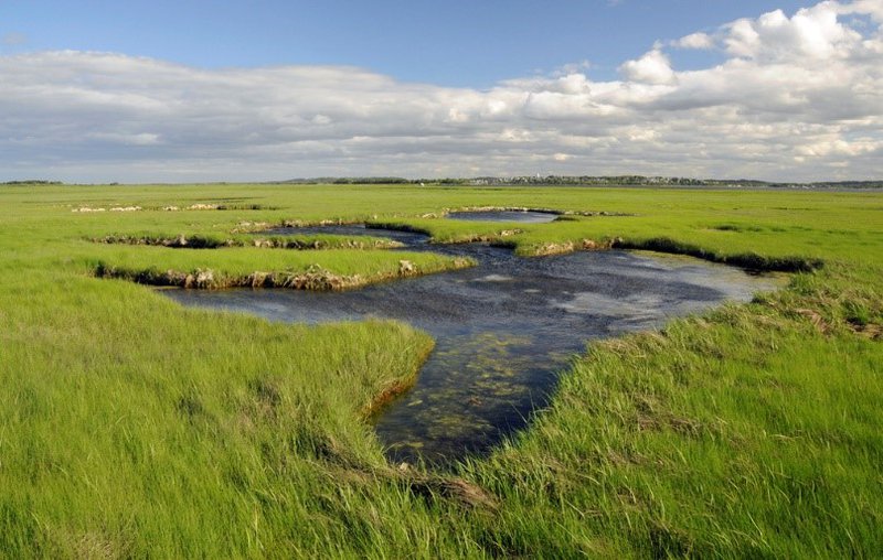
The land types most exposed are beaches and dunes (called “unconsolidated shore” in NOAA’s land cover categories), estuarine wetlands (i.e., salt marshes), and open water, which includes freshwater ponds and impoundments that are susceptible to saltwater intrusion. We estimate that 3.2 million acres of estuarine wetlands in total would be impacted by a 3-foot rise in sea levels, with 2.4 million of those acres in the southeastern states of North Carolina, South Carolina, Georgia, and Florida. Approximately 60 percent of these 2.4 million acres is comprised of protected lands, and public lands agencies in the southeastern states therefore face the daunting challenge of how to restore or replace the valuable ecosystem services provided by these lands. Wetlands attenuate storm surge from hurricanes, store carbon, filter nutrients, provide fish nurseries and wildlife habitat, and are important recreational amenities. Sea-level rise will affect all of these services.

To assess how well-positioned states might be to respond to these challenges, we compared the progress states have made in developing climate adaptation plans (using information primarily from the Georgetown Climate Center), with a close eye on whether those plans addressed protected lands, as well as states’ overall levels of annual spending on land conservation (using data from the Trust for Public Land’s Conservation Almanac).
The three states with the highest proportions of protected lands that will be affected by a 3-foot rise in sea level—North Carolina, South Carolina, and Georgia—are also the only states in our study area that have not begun developing state adaptation plans. Although federal agencies manage a large share of the protected lands in North Carolina and South Carolina, all three states have substantial state-owned acreage. States differ significantly in their spending on conservation. Interestingly, Florida, which has the most state-owned lands at risk from sea-level rise, also spends the most on conservation—more than twice as much annually as New Jersey, which ranks second in conservation spending. Two of the states that spend the least are South Carolina and Georgia, both of which have significant state-owned lands at risk.
Maryland is a leader in preparing for climate change, especially in its effects on protected lands. The state’s GreenPrint program, which is used to target lands for protection, has been modified in recent years to identify wetlands that are likely to be submerged by sea-level rise, as well as wetland migration corridors that will facilitate the inward movement of wetlands. In addition, all areas that are candidates for easements and acquisitions through the state’s conservation program, Program Open Space, are individually geospatially evaluated for their adaptation services, including storm surge attenuation, carbon sequestration, coastal ecosystem viability, and recreation. In our view, other states could learn from Maryland and take steps to restore and replace their valuable investments in coastal protected lands.


